We got some good doses of rain!


When it rains it pours - makes for interesting driving. The storm drain on the street outside my window:

Clogged! It's now a small lake! It made for some interesting driving:

Do you remember jumping into puddles when you were a kid?
This is the adult automotive equivalent. Don't be standing on that corner!
LINKS
Hope all these work for you.
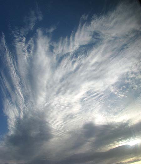
Polar stratospheric cloud
Something i stumbled upon, looks a few i have seen:
Polar stratospheric clouds or PSCs, also known as nacreous clouds, are clouds in the winter polar stratosphere at altitudes of 15,000–25,000 meters

A most devoted sky watcher reported:
where does the term nacreous come from?

It looks a lot like an abalone shell, commonly found on the the No. Ca. coast.

----------------------------------------------
Plenty of talk about drought:
Megadroughts, rather scientific
"They are suspected of playing a primary role in the collapse of several pre-industrial civilizations, including the Anasazi of the North American Southwest, the Khmer Empire of Cambodia, the Mayan of Mesoamerica, the Tiwanaku of Bolivia, and the Yuan Dynasty of China."
"When megadroughts occur, lakes dry up and trees and other plants grow in the dry lake beds. When the drought ends the lakes refill, when this happens the trees are submerged and die. In some locations these trees have remained preserved and can be studied giving accurate radio-carbon dates, and the tree rings of the same long dead trees can be studied. Such trees have been found in Mono and Tenaya lakes in California, Lake Bosumtwi in Ghana; and various other lakes."
"During a 200-year mega drought in the Sierra Nevada that lasted from the 9th and 12th centuries, trees would grow on newly exposed shoreline at Fallen Leaf Lake, then as the lake grew once again, the trees were preserved under cold water."
------------------
Persistent drought in North America:
a climate modeling and paleoclimate perspective
Richard Seager
Lamont-Doherty Earth Observatory of Columbia University
A millennium of North American droughts and pluvials
A farm during the Dust Bowl. This one is in South Dakota during May 1936.
For year after year across vast areas of North America rainfall was low. Summers were parched and the heat excessive. Plants withered and sand dunes moved freely across a formerly green landscape. Human settlements had to be abandoned and populations migrated, forcing social change. By some measures the drought lasted more than a decade.
No, this is not a description of the Dust Bowl drought of the 1930s but of the truly severe drought of the late thirteenth century, which coincided with the end of the Anasazi civilization. It could just as easily describe the severe drought of the late sixteenth century. Or it could describe the droughts of the mid-Holocene which so taxed the indigenous peoples of the Great Plains."
'A tree stump in Mono Lake in California that grew during an ancient drought and was submerged when wet years returned. Scott Stine used carbon dating of stumps to recreate the drought history of the area'

Photo - Scott Stine
Another excellent weather blog for those on the north west coast - CA, OR, & Washington:
http://www.nytimes.com/2016/10/23/magazine/why-isnt-the-us-better-at-predicting-extreme-weather.html
Even with drought, a California river will begin flowing year-round for the first time in 60 years
A decade ago, environmentalists and the federal government agreed to revive a 150-mile stretch of California's second-longest river, an ambitious effort aimed at allowing salmon again to swim up to the Sierra Nevada foothills to spawn.
A major milestone is expected by the end of the month, when the U.S. Bureau of Reclamation says the stretch of the San Joaquin River will be flowing year-round for the first time in more than 60 years.

Some news is good:
"We're currently at over 17 inches of liquid for October and November combined—that's 200 percent above normal—and haven't had that high of a reading since 1985-86.
"It has really been a pretty good start to the water year," Kurth, who work's in the NOAA's Sacramento office, said. "We had a really wet October. We had a dry start to November, but last week things changed."
----------------------------
Fall snow, rains have 'satisfied the drought debt' in Northern Sierra Nevada, climatologist says
In the days leading up to Thanksgiving, concerns over dry conditions were quickly dispatched when more than two feet of snow dropped around the lake in just two days.
Let's see what happens - you can tell from al the links above, there is much room for discussion!